Coastal Activity Report
Designed to provide stakeholders with a clear understanding of site evolution, this service leverages multitemporal multispectral satellite imagery to monitor human and environmental changes in a specific area of interest. The end user receives a cohesive analysis of a series of satellite captures, identifying and synthesizing significant shifts in coastal dynamics, ranging from infrastructure expansion and vessel traffic patterns to shoreline erosion and habitat migration.TCarta utilizes change-detection algorithms to highlight new construction, land reclamation, or the development of nearshore assets, making it an essential tool for regulatory compliance, environmental impact assessments, and strategic planning. Whether monitoring the progress of a port expansion or tracking the seasonal health of a mangrove ecosystem, the Coastal Activity Report delivers a high-level overview of the cumulative impacts affecting a specific coastal region. Delivery is flexible to the end users requirements.
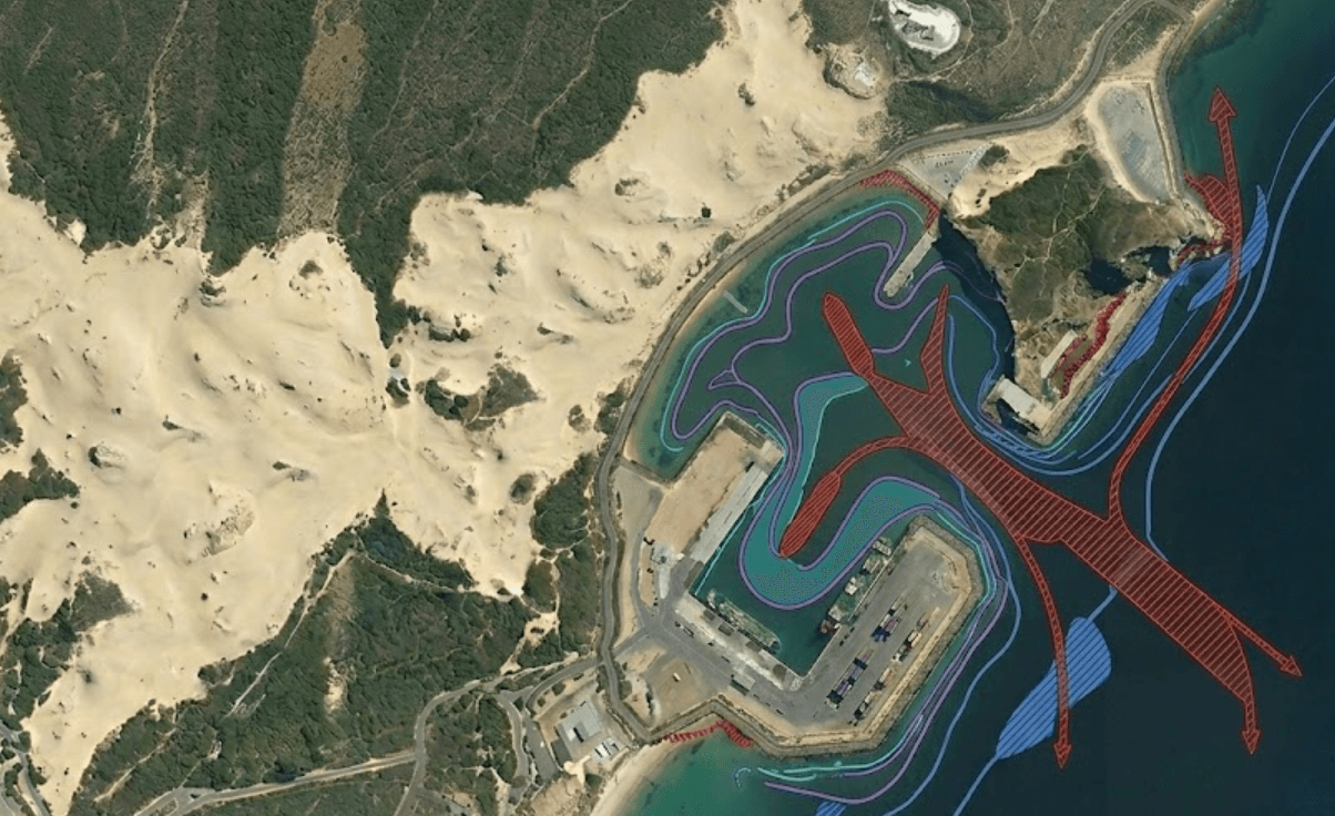
Provides an essential decision-making and planning tool for holistic understanding and response to environmental changes and impacts in a focused temporal and geographic zone.
SAR, MSI
Detailed report & support map package highlighting patterns in change, customizable analysis-ready dashboard