Blue Carbon Mapping
With satellite-based technology and advanced imaging techniques, TCarta helps organizations protect and invest in blue carbon ecosystems
A vital role in climate change mitigation
Efforts to curb climate change are increasingly focused on the “blue carbon” stored by salt marshes, mangroves, and seagrass meadows in coastal saltwater ecosystems. When disturbed, these environments can release enormous amounts of carbon dioxide back into the atmosphere. But if preserved or restored, they act as massive carbon sinks, playing a vital role in climate change mitigation. And now, satellite-based techniques for mapping and monitoring these ecosystems offer a quick, verifiable, and non-intrusive approach to protecting blue carbon resources.
New currency in a growing carbon-capture market
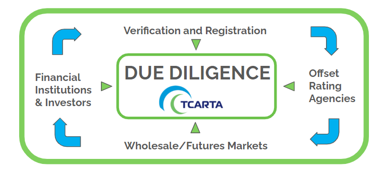
For island nations, nonprofit organizations, businesses, and financial institutions, blue carbon ecosystems offer vast potential, both in slowing the effects of global warming and as currency in a burgeoning market based on carbon-capture credits. With the right tools and reliable data verifying the extent and health of blue carbon environments, organizations can:
Develop preservation plans
Island nations can assess the past and present conditions of their blue carbon ecosystems and determine rates of loss, allowing them to slow further degradation, designate marine-protected areas, and create comprehensive plans for monitoring their blue carbon resources.
Leverage blue carbon assets as capital
Additionally, with accurate assessments and verification of their resources, island nations can create plans to monetize their blue carbon, using proceeds to invest further in sustainable development.
Gauge the value of blue carbon offerings
Reliable insight allows banking institutions, impact investors, parametric insurance companies, and nonprofits to determine which blue carbon initiatives and offerings are optimal for investments and partnerships.
Offset emissions
Assessment and verification with satellite-based remote sensing technologies also guide corporations and businesses in choosing effective blue carbon credit programs to offset their own carbon emissions.
Protect and invest in blue carbon ecosystems with TCarta
In the evolving blue carbon economy, reliable data is still in short supply and often at a low spatial resolution. Traditional methods for assessing the size and health of blue carbon environments—gathering measurements by boat or cutting down vegetation—are time consuming, inconvenient, and subject to human error.
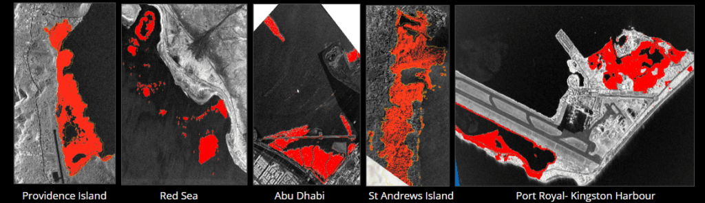
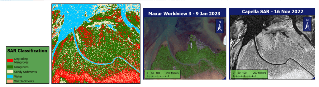
TCarta offers an alternative, non-invasive solution for mapping and measuring blue carbon environments, using the latest in satellite technology to capture imagery at a resolution that is unmatched in the global market. Combining multispectral, hyperspectral, 3D, and synthetic aperture radar (SAR) tools with advanced image interpretation and classification methods, we provide organizations with the data they need to preserve ecosystems and assess blue carbon resources for carbon-credit exchange.
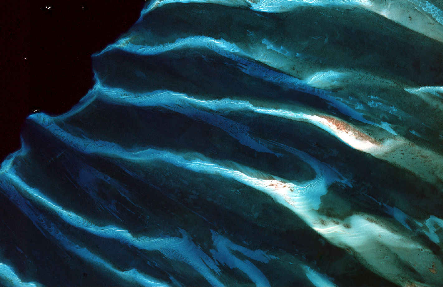
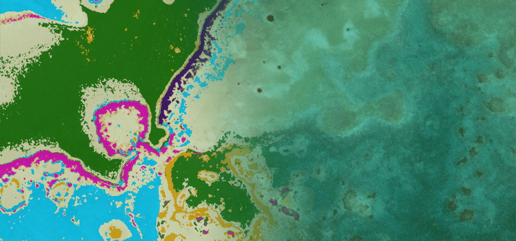
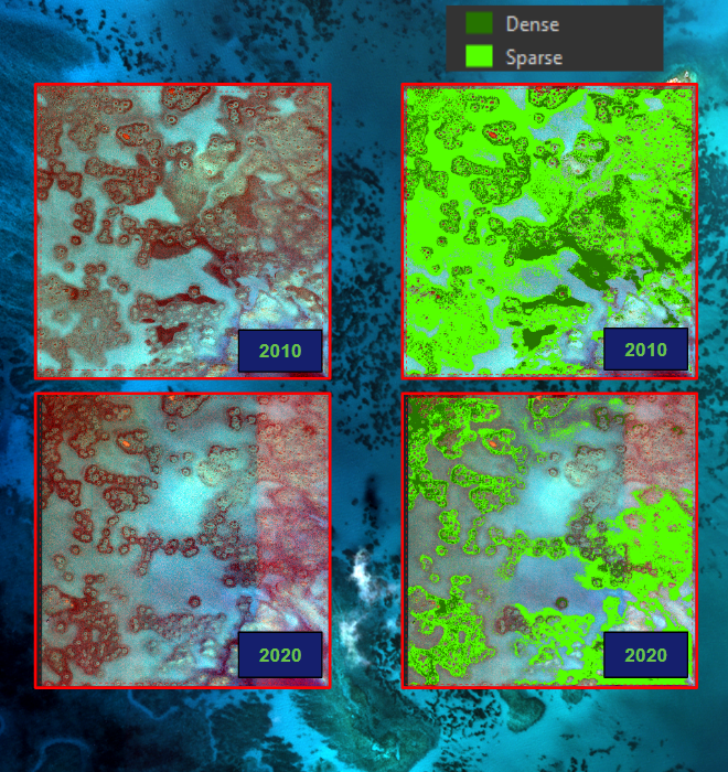
TCarta provides critical historical seagrass mapping in the Bahamas
Teaming with global nonprofit Beneath the Waves and public-private partnership Carbon Management Ltd., TCarta recently provided its satellite-based mapping services to assess 300,000 square kilometers of coastal ecosystem in the Great Bahama Bank. The effort focused on gauging the size and health of the shoal’s seagrass beds, which offer critical carbon sequestration, erosion prevention, and water quality benefits in the region. Using Maxar satellite imagery and detailed classification techniques, TCarta assessed the density of seagrass throughout the Bahamas, delivering key insight into the amount and rate of loss occurring in the region over the course of a decade.
83% of the global carbon cycle is circulated through the ocean. Satellite imagery is vital to mapping and monitoring these crucial areas. TCarta is the trusted source for coastal insights from space.
Seagrass
- Occupies < 0.2% of ocean floor
- Responsible for 10% of organic carbon buried in ocean
- Seagrasses are being lost at a rate of 1.5% per year and have lost approximately 30% of historical global coverage
Mangroves
- Carbon emissions from mangrove deforestation account for up to 10% of emissions from deforestation globally, despite covering just 0.7% of land coverage.
- Are being lost at a rate of 2% each year
