• Skip to primary navigation
  • Skip to main content
TCarta Satellite-Based Hydrospatial Tech

TCarta Satellite-Based Hydrospatial Tech

We are your contact for Marine Remote Sensing and Hydrospatial data services.

  • Who We Are
    • About
    • Partnerships & Affiliations
  • What We Do
    • What is Hydrospatial?
    • What Do We Measure?
    • How to Work with TCarta
  • Products & Services
    • Products
      • Global Bathymetry GIS
      • Satellite-Derived Bathymetry
      • Seafloor Classification
      • Newsletter Archive
      • Marine Basemaps
    • Services
      • Blue Carbon Mapping
      • Synthetic Aperture Radar (SAR)
      • Satellite-Derived Water Quality
      • Trident Tools Satellite-Derived Bathymetry Software
    • Custom Solutions
  • Case Studies
    • Space-based Hydrospatial Solutions for Engineering Projects in the Littoral Zone
    • Technology Demonstration Project: Large-Scale Satellite Derived Bathymetry Mapping
    • Hydrographic Office Technology Integration
    • Updating Information on Nautical Charts in Baffin Island, Canada
  • News & Press
    • Newsroom
    • Blogs
  • Product Viewer
  • Contact
  • Show Search
Hide Search

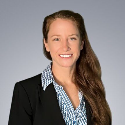
Julia Waldsmith

Senior Geospatial Scientist

Location: Denver, CO

Contact

Phone: +1 303-284-6144

Email: Julia@tcarta.com

Biography


Julia is a geospatial scientist who started her career as a geologist deep in Nevada gold mines, then shifted to oil and gas exploration in Houston.  From there, she joined the NOAA Corps and operated both hydrographic research vessels, drones, and aerial surveying platforms in all corners of the United States.  Her career has remained operational and geospatial since it began with her fascination with geoscience and our world as a student at the University of Illinois.  Since then, she has refined her professional skills with NOAA’s Mid Career Leadership Development Program, honed her experience as a geospatial professional with a Master of Science in GIS and Remote Sensing at the University of Maryland, and earned the International Hydrographic Organization’s Category B Certificate in Nautical Cartography.  

Julia loves enjoying the outdoors, whether exploring for interesting rocks, plants, or animals with her husband.  When she is not outside, she is usually trying out a new recipe!

Expertise

Trident Tools Software

Satellite-Derived Bathymetry

Global Bathymetry

Government Projects &
Research Grants

BACK TO BIOS

Ready to get started?

Get in touch

Subscribe to our newsletter


Loading

TCarta Marine LLC

1015 Federal Boulevard
Denver, CO 80204, USA

+1 (303) 284-6144

TCarta Caribe LLC

26 Haining Road
New Kingston, Jamaica

+1 (876) 817-8567

TCarta Canada Services Ltd.

1771 Robson Street - 1508
Vancouver, BC, V6G 3B7 CA

  • What We Do
  • Legal
  • Contact
  • LinkedIn
  • Instagram
  • Facebook
  • Twitter