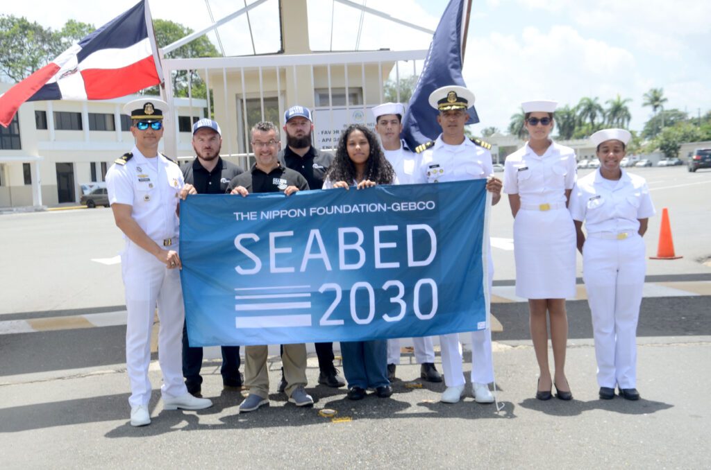
Five members of the Dominican Republic Navy received training and instruction to work on detecting sargassum

Members of the Dominican Navy received training to work on sargassum detection and Satellite Derived Bathymetry (SDB). In addition, participants received additional training on how to identify sargassum using satellite imagery. However, sargassum is known to come to our beaches and coastal areas, creating a nuisance for both tourists and locals. Likewise, this multi-day training was made possible thanks to the collaboration between the Nippon Foundation-GEBCOSeabed2030 project and TCartaMarine with the Dominican Navy.
This training comes at a very important time considering that the country’s Hydrographic Service has been inactive for around 30 years. Since 2015, great efforts have been made to learn new technologies and experts within the Navy and contribute to the country.
Nippon Foundation and its help in the detection of sargassum
A collaboration between the Nippon Foundation and the General Bathymetric Chart of the Ocean (GEBCO), which operates under the joint auspices of the International Hydrographic Organization and the Intergovernmental Oceanographic Commission (IOC) of UNESCO, Seabed 2030 is a global accelerator of ocean mapping. Seabed 2030 inspires the complete mapping of the global ocean by 2030.
The Dominican Republic has been a member of the IHO since 1967. Just last year at the National Palace, President Abinader received the Director of the IHO, Luigi Sinapi. There, the sustainable use of the oceans and the importance of hydrography in the Dominican Republic were discussed. SDB is an ideal method for collecting bathymetry measurements in shallow waters. TCarta founder Kyle Goodrich on the importance of training for communities and institutions around the world.
Advances in hydrography in the Dominican Republic
Thanks to the Commander General of the Navy, Vice Admiral Agustín Morillo Rodríguez , members of the Navy received training in how to process and compile SDB data. Including Frigate Captain Primitivo López, Director of the Hydrographic Service
Sheila Caceres, a member of the Seabed 2030 Atlantic and Indian Ocean Regional Centre. She helped establish this collaboration and training opportunity, and is attending the training event.
In addition, this training is a set of national coastal bathymetry data with ten-meter resolution generated by the Hydrographic Service. This for use in environmental models, conservation efforts and other specialized uses within the Service. In addition, this training leaves a group of technical experts in SDB for the Navy. With the capacity to continue developing, transmitting the knowledge and skills learned. The objective is to update nautical charts in order to have safe navigation for ships in jurisdictional waters.

