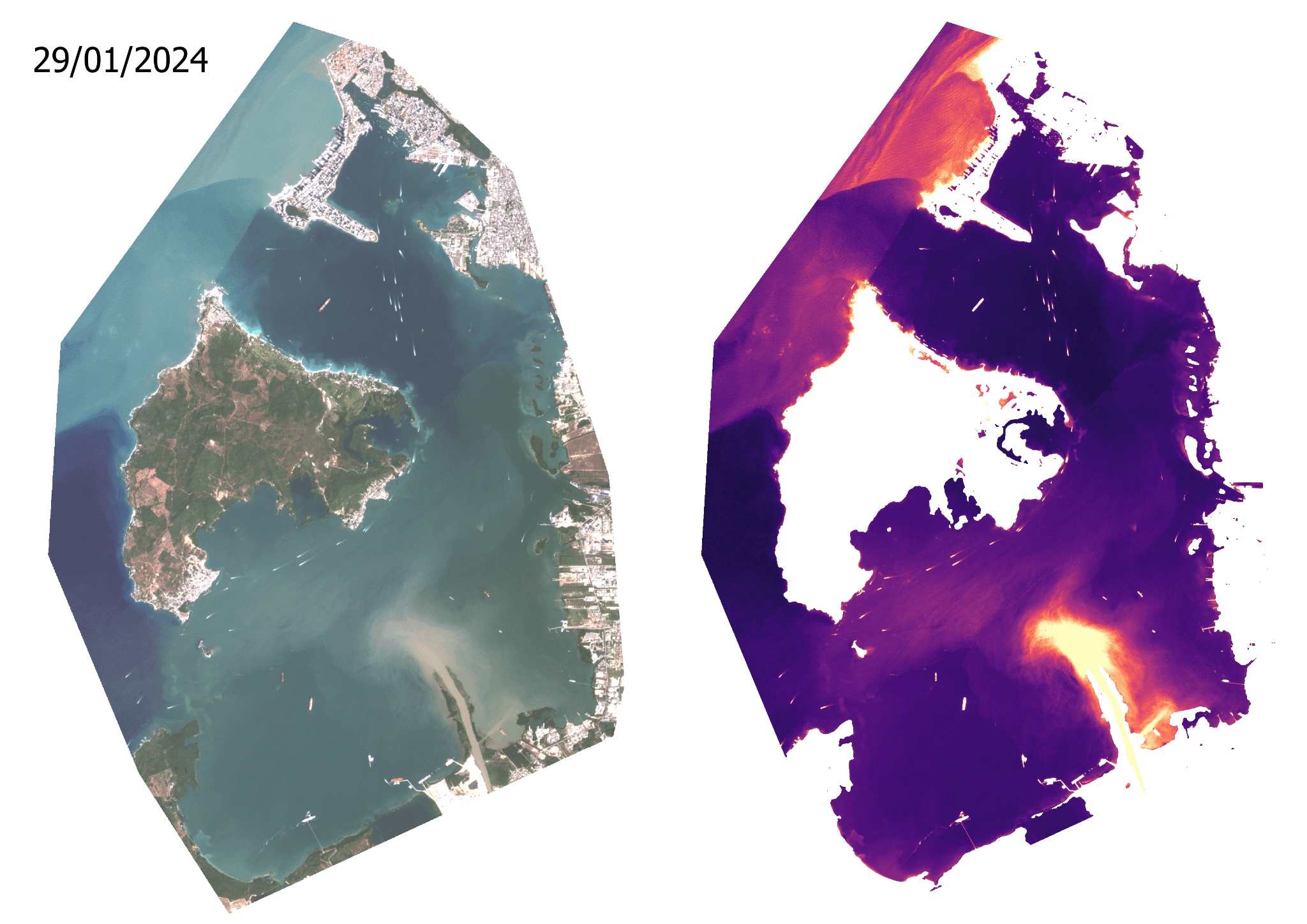
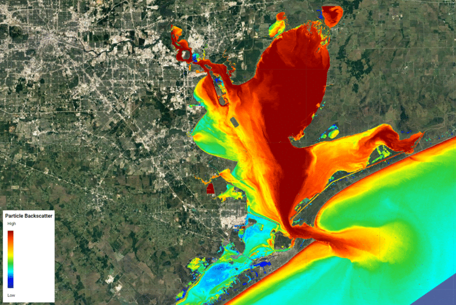
Water Quality Monitoring
This service provides daily water quality measurements for key parameters, including turbidity, secchi depth, chlorophyll-a concentration, suspended particulate matter, and dissolved organic matter. Users are able to interpret trends easily, as the daily measurements are contextualized against historical averages and presented in an interactive dashboard. The data is derived from high-resolution optical imagery, specifically PlanetScope 3m or Sentinel-3 300m, and leveraging the Sentinel-2 archive allows for historical trend analysis dating back to 2016. This service is highly valuable for applications like environmental impact assessments, seagrass restoration site assessments, and airborne LiDAR planning and operations, allowing users to optimize flight windows based on historical clarity trends and current water conditions. While delivery format is flexible, this service is most often delivered through a customized dashboard.

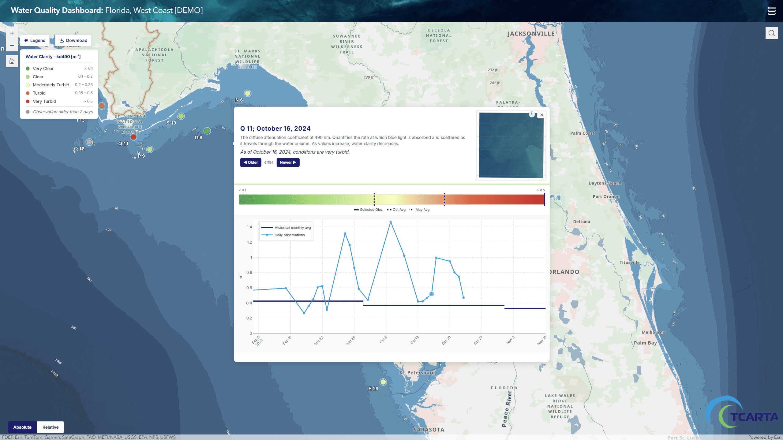
Custom Water Quality Dashboard
Provides continuous, satellite-derived measurements of key parameters like turbidity and chlorophyll-a, offering historical trend analysis and actionable intelligence to optimize planning for environmental assessments and LiDAR operations.
High resolution optical satellite imagery (PlanetScope 3m, Sentinel-3 300m, Sentinel 2, etc.)
Typically delivered in a customized dashboard. TCarta can provide a variety of services for consumption.