We value your privacy

We use cookies to enhance your browsing experience, serve personalized ads or content, and analyze our traffic. By clicking "Accept All", you consent to our use of cookies.

Customize Consent Preferences

We use cookies to help you navigate efficiently and perform certain functions. You will find detailed information about all cookies under each consent category below.

The cookies that are categorized as "Necessary" are stored on your browser as they are essential for enabling the basic functionalities of the site. ... 

Always Active

Necessary cookies are required to enable the basic features of this site, such as providing secure log-in or adjusting your consent preferences. These cookies do not store any personally identifiable data.

No cookies to display.

Functional cookies help perform certain functionalities like sharing the content of the website on social media platforms, collecting feedback, and other third-party features.

No cookies to display.

Analytical cookies are used to understand how visitors interact with the website. These cookies help provide information on metrics such as the number of visitors, bounce rate, traffic source, etc.

No cookies to display.

Performance cookies are used to understand and analyze the key performance indexes of the website which helps in delivering a better user experience for the visitors.

No cookies to display.

Advertisement cookies are used to provide visitors with customized advertisements based on the pages you visited previously and to analyze the effectiveness of the ad campaigns.

No cookies to display.

  • Skip to primary navigation
  • Skip to main content
TCarta Satellite-Based Hydrospatial Tech

TCarta Satellite-Based Hydrospatial Tech

We are your contact for Marine Remote Sensing and Hydrospatial data services.

  • Who We Are
    • About
    • Partnerships & Affiliations
  • What We Do
    • What is Hydrospatial?
    • What Do We Measure?
    • How to Work with TCarta
  • Products & Services
    • Products
      • Global Bathymetry GIS
      • Satellite-Derived Bathymetry
      • Seafloor Classification
      • Newsletter Archive
      • Marine Basemaps
    • Services
      • Blue Carbon Mapping
      • Synthetic Aperture Radar (SAR)
      • Satellite-Derived Water Quality
      • Trident Tools Satellite-Derived Bathymetry Software
    • Custom Solutions
  • Case Studies
    • Space-based Hydrospatial Solutions for Engineering Projects in the Littoral Zone
    • Technology Demonstration Project: Large-Scale Satellite Derived Bathymetry Mapping
    • Hydrographic Office Technology Integration
    • Updating Information on Nautical Charts in Baffin Island, Canada
  • News & Press
    • Newsroom
    • Blogs
  • Product Viewer
  • Contact
  • Show Search
Hide Search

What is Hydrospatial?

Though only recently coined by pioneering bathymetry professionals, the term “hydrospatial” still strikes at the core of TCarta’s mission as a company. But what does it mean, exactly?

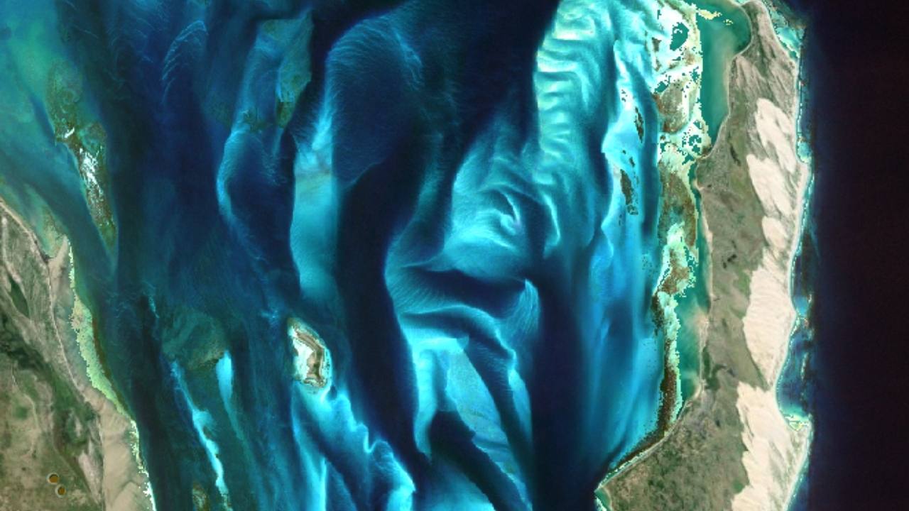
While “geospatial” describes data associated with a geographic location on Earth, “hydrospatial” refers specifically to the analysis of and access to marine data, including depth measurements and descriptions of physical features in oceans, seas, coastal areas, lakes, and rivers.

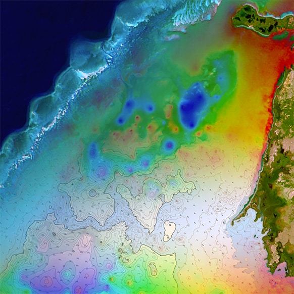
At TCarta, we were some of the first innovators to adopt a space-based approach to producing bathymetric charts and datasets. Using remote satellite imagery and satellite derived data points, TCarta: 

  • Surveys the physical seafloor, gauging water depth, identifying and classifying features, detecting hazards and measuring coastal erosion via coastal bathymetry
  • Gauges biomass volumes and tracks sargassum mats with remote sensing satellite images
  • Predicts and monitors harmful algal blooms, analyzes seasonal patterns, and determines the health of mangroves and reefs
  • Assesses the health of marine environments remotely over time and produces future forecasts
  • Provides water quality and temperature time series data to offer remote chemical analyses, both for microsites and on a large continental scale

As a leading satellite-derived bathymetry provider, TCarta plays a vital role in filling gaps in hydrospatial data worldwide. We’re a proud contributor to global ocean-focused initiatives, like Seabed 2030, the collaborative effort to map the entire ocean floor by 2030. We were also collaborators with the United Nations Decade of Ocean Science, dedicated to reversing the cycle of decline in ocean health.

Ready to get started on your next project with us?

Get in touch

Subscribe to our newsletter


Loading

TCarta Marine LLC

1015 Federal Boulevard
Denver, CO 80204, USA

+1 (303) 284-6144

TCarta Caribe LLC

26 Haining Road
New Kingston, Jamaica

+1 (876) 817-8567

TCarta Canada Services Ltd.

1771 Robson Street - 1508
Vancouver, BC, V6G 3B7 CA

  • What We Do
  • Legal
  • Contact
  • LinkedIn
  • Instagram
  • Facebook
  • Twitter