Coastal Monitoring
Satellite imagery is used to map dynamic coastal environments and quantify shoreline and bathymetry changes over time. By analyzing historical and current satellite imagery, this service identifies critical patterns of erosion and accretion, providing information needed to plan projects, protect infrastructure, and manage natural resources. From detecting subtle seasonal shifts to documenting long-term coastal retreat, satellite-driven coastal monitoring offers a scalable, objective view of the coast. In addition to shoreline and bathymetry mapping, benthic habitats and water quality can also be monitored from space and included with this product.
Provides a scalable and objective record of shoreline and bathymetry changes over time, supplying the critical intelligence needed to protect infrastructure and manage natural resources.
Multispectral satellite imagery, ICESat-2 Bathymetry, available in situ measurements
10m, 3m, 2m, and sub-meter models in Esri FileGeodatabase; satellite imagery RGB (GeoTIFF), Google Earth KMZ project map, GeoPackage detailed descriptive survey report; optionally delivered in a customizable analysis-ready dashboard
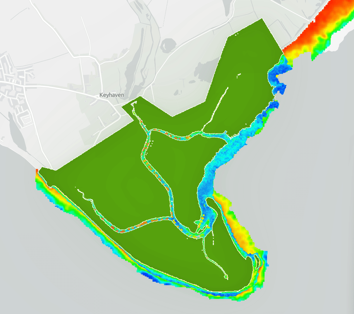
Shoreline Mapping in the UK
TIme Series Shoreline mapping highlights tidal influence on the coastline