SAR Shoreline
By combining optical imagery with Synthetic Aperture Radar (SAR), TCarta monitors shoreline erosion and accretion providing a continuous record of coastal change for resilience planning. With precise image tasking at high or low tide, the shoreline can be delineated, accurately informing and augmenting available chart data. Change detection can be performed to quantify change over time, and the SAR Shoreline product can be used in weather and erosion modeling.
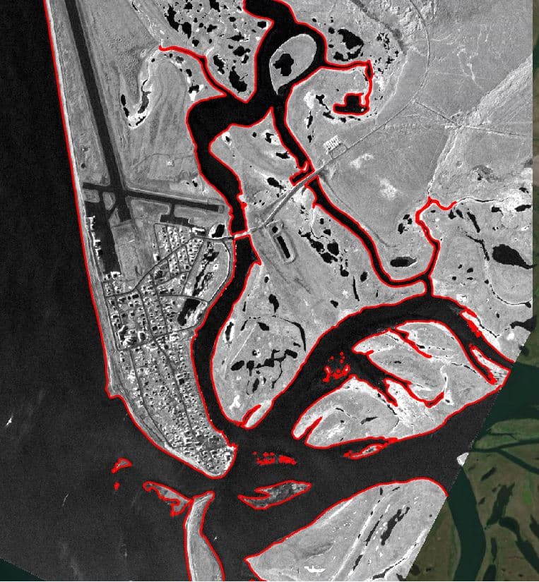
Up-to-date, precise shoreline and intertidal mapping in dynamic or volatile locations without putting boots on the ground.
SAR Imagery from Sentinel-1 or Capella
10m, 3m, 2m, and sub-meter models in Esri FileGeodatabase; satellite imagery RGB (GeoTIFF), Google Earth KMZ project map, GeoPackage, GeoJSON, detailed descriptive survey report