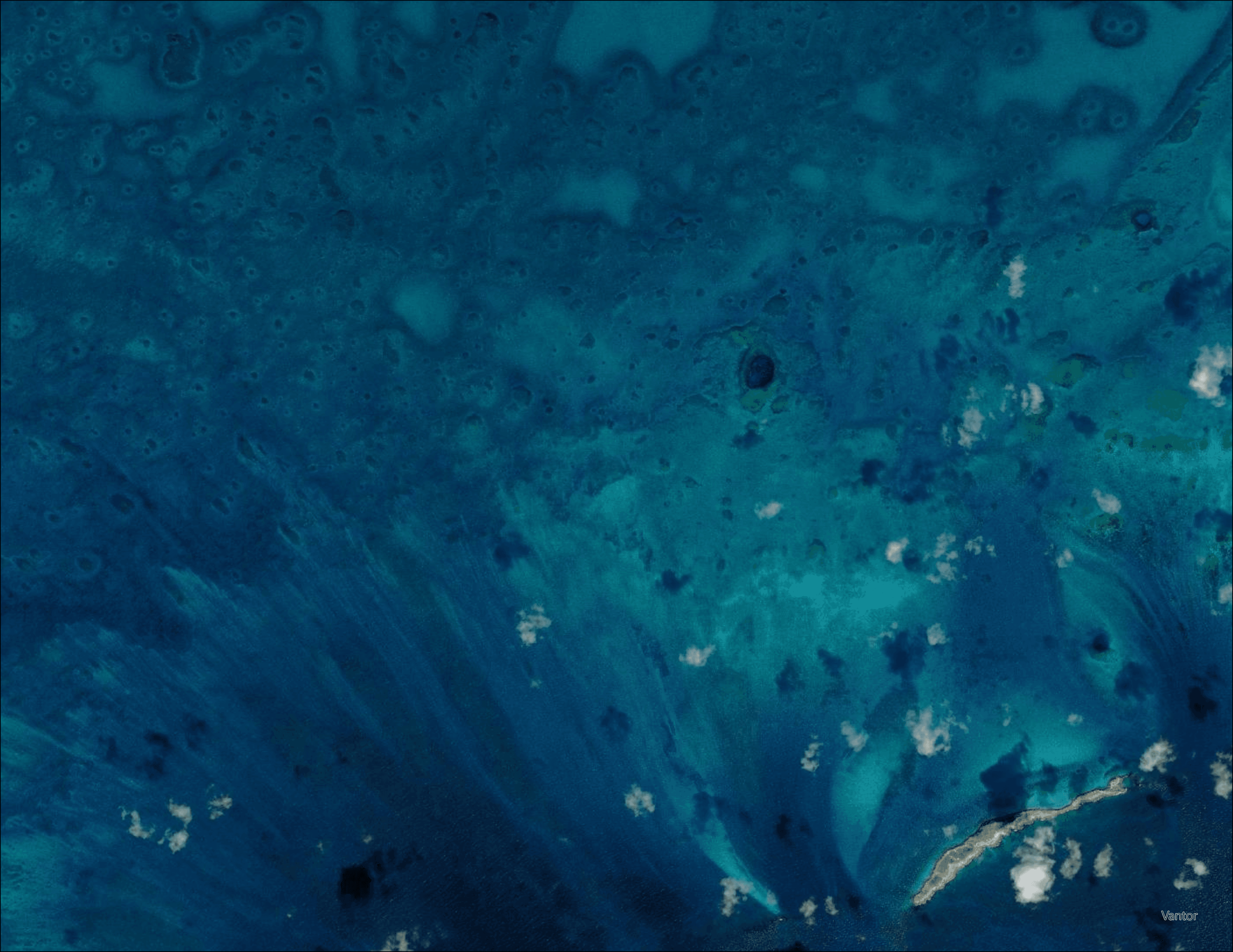
Seagrass Mapping
This service enables quantification of seagrass extent, density, and changes in extents and health across large geographic areas over time. This vital capability, which supports seagrass monitoring initiatives, marine protected area management, environmental impact assessments, and blue carbon accounting, is delivered at resolutions as detailed as 30 cm. Seagrass mapping is achieved by custom sensor fusion algorithms that combine the high spatial resolution from multispectral sensors with the detailed spectral information from hyperspectral data. Delivery formats are flexible and customized to project requirements and goals, including GIS-ready files and analysis-ready dashboards.
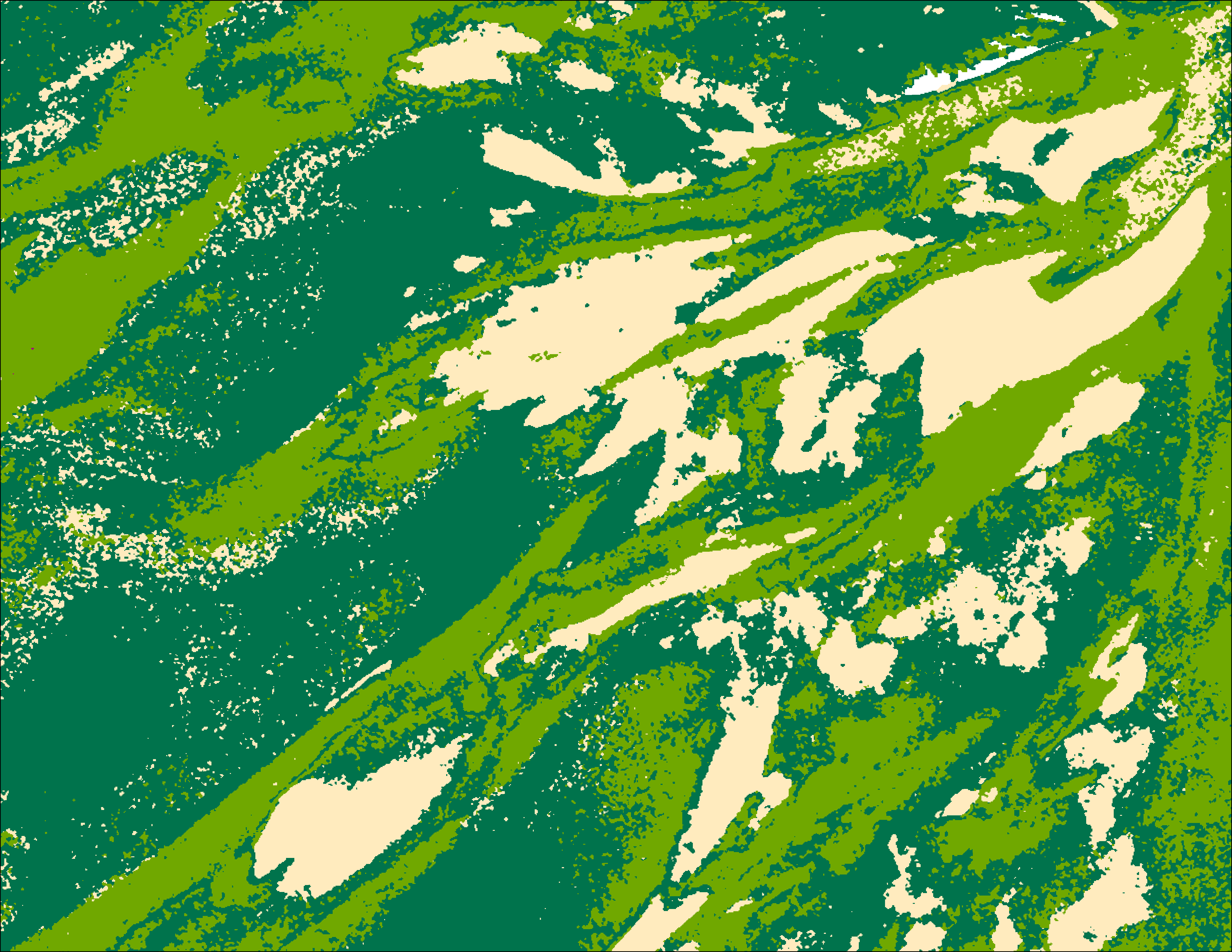
Seagrass Classification in Mauritania
Multi-temporal, high-resolution, large-scale analysis of seagrass meadows provides invaluable information for conservation and restoration initiatives without environmental impact.
Multispectral satellite imagery, Hyperspectral Imagery, ICESat-2 Bathymetry, available in situ measurements
10m, 3m, 2m, and sub-meter models in Esri File Geodatabase; satellite imagery RGB (GeoTIFF), Google Earth KMZ project map, GeoPackage, detailed descriptive survey report; optionally delivered in a customizable analysis-ready dashboard