• Skip to primary navigation
  • Skip to main content
TCarta Satellite-Based Hydrospatial Tech

TCarta Satellite-Based Hydrospatial Tech

We are your contact for Marine Remote Sensing and Hydrospatial data services.

  • Who We Are
    • About
    • Partnerships & Affiliations
  • What We Do
    • What is Hydrospatial?
    • What Do We Measure?
    • How to Work with TCarta
  • Products & Services
    • Products
      • Global Bathymetry GIS
      • Satellite-Derived Bathymetry
      • Seafloor Classification
      • Newsletter Archive
      • Marine Basemaps
    • Services
      • Blue Carbon Mapping
      • Synthetic Aperture Radar (SAR)
      • Satellite-Derived Water Quality
      • Trident Tools Satellite-Derived Bathymetry Software
    • Custom Solutions
  • Case Studies
    • Space-based Hydrospatial Solutions for Engineering Projects in the Littoral Zone
    • Technology Demonstration Project: Large-Scale Satellite Derived Bathymetry Mapping
    • Hydrographic Office Technology Integration
    • Updating Information on Nautical Charts in Baffin Island, Canada
  • News & Press
    • Newsroom
    • Blogs
  • Product Viewer
  • Contact
  • Show Search
Hide Search
TCarta Marine

OGC Demonstrator Showcases TCarta’s Space-Based Approach to Intertidal Zone Monitoring

TCarta Marine · April 23, 2025 · Leave a Comment

In contribution to the OGC Federated Marine Spatial Data Infrastructure (FMSDI) 2025, TCarta successfully demonstrated the power of satellite technology in monitoring dynamic coastal environments. This OGC demonstrator—centered on the Hurst Spit region in the UK—highlighted how space-based data can significantly improve hydrospatial awareness and coastal zone management.
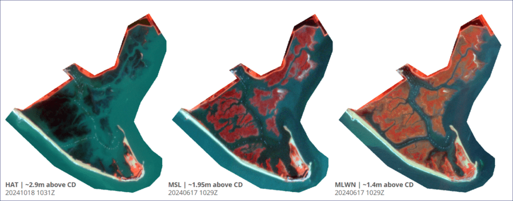
Planet Labs imagery demonstrates the significant tide-range present around Hurst Spit, UK​

Leveraging multispectral imagery from PlanetLabs and Synthetic Aperture Radar (SAR) data from Capella Space, TCarta derived high-resolution coastline vectors and intertidal zone boundaries tied to real-time water levels. These vectors, available as both a time series and real-time snapshots updated every five minutes, were benchmarked against tide gauges and tide models, offering high temporal accuracy.
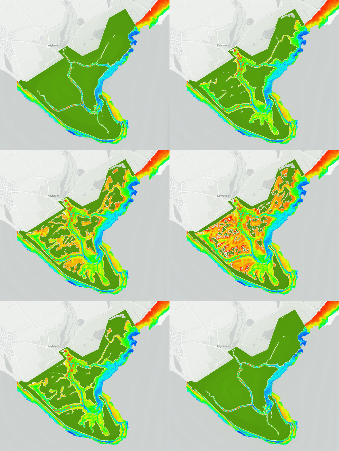
Gif demonstrates Satellite Derived Coastline changes(green) in 5 minute increments, overlaid with Satellite Derived Bathymetry

To ground truth and validate the results, TCarta compared their satellite-derived coastlines with traditional datasets from the UK Hydrographic Office and Ordnance Survey. This revealed critical variations based on data source, resolution, and tide level, underscoring the challenges of managing a constantly shifting land-sea interface.

The demonstrator also featured satellite-derived bathymetry (SDB) using Sentinel-2 and PlanetScope imagery, showcasing how space-based remote sensing methods produce reliable depth data in areas inaccessible to traditional survey methods. These datasets, delivered via OGC-compliant APIs and visualized through a custom web application, enable integrated coastal monitoring and data sharing across platforms.
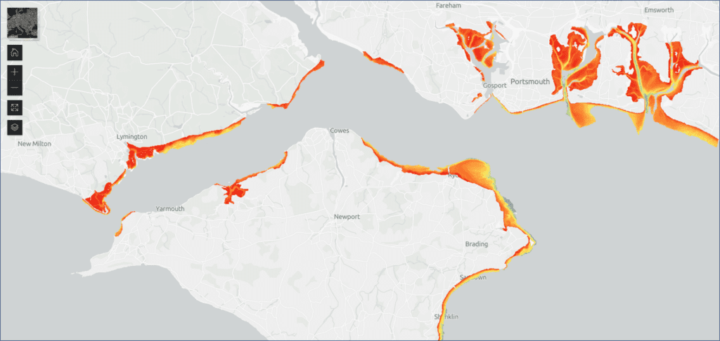
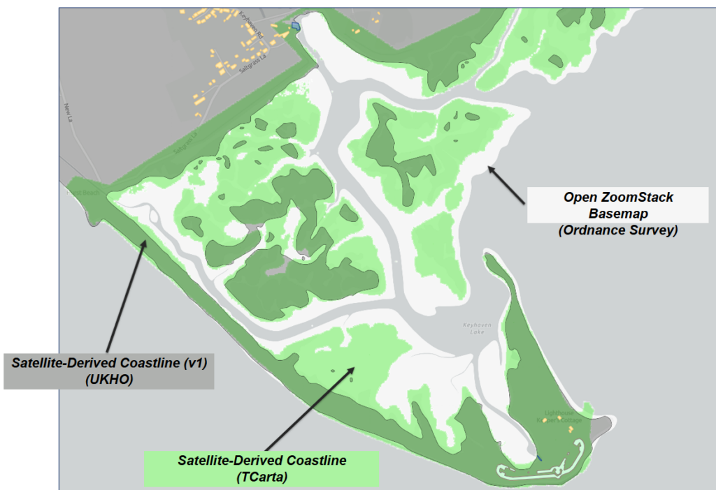
There are multiple, disparate coastline and intertidal features from different sources

Lessons learned emphasized the influence of vegetation, seasonality, and spatial resolution on remote sensing outputs, while recommendations pointed toward the use of dynamic, water-level-attributed coastline products and the integration of AI/ML for improved feature classification.

TCarta’s demonstrator is a powerful proof of concept for how space-based technologies can bridge the gap between terrestrial and marine data, offering scalable, near-real-time solutions for coastal resilience, planning, and environmental stewardship.

Click here to view and interact with the OGC demonstrator!

Back to Blogs

Blog

Reader Interactions

Leave a Reply Cancel reply

Your email address will not be published. Required fields are marked *

Subscribe to our newsletter


Loading

TCarta Marine LLC

1015 Federal Boulevard
Denver, CO 80204, USA

+1 (303) 284-6144

TCarta Caribe LLC

26 Haining Road
New Kingston, Jamaica

+1 (876) 817-8567

TCarta Canada Services Ltd.

1771 Robson Street - 1508
Vancouver, BC, V6G 3B7 CA

  • What We Do
  • Legal
  • Contact
  • LinkedIn
  • Instagram
  • Facebook
  • Twitter